Plans for the eventual redevelopment of Billingsgate Fish Market and the building on top of Aspen Way move one step closer, following the adoption of the South Poplar Masterplan Supplementary Planning Document (SPD) in July 2021.
This supports the aspirations and policies contained within the east London borough’s Local Plan until 2031.
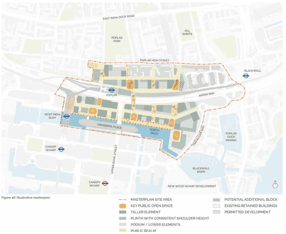
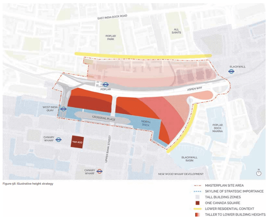
South Poplar which covers part of the Canary Wharf estate and Billingsgate Fish Market in the south which is separated by the more established communities to the north of the 6-lane Aspen Way and Poplar Docklands Light Railway station and associated depot.
The purpose of the plan is to provide a master plan and detailed guidance as a template for individual schemes that will eventually be submitted to the London Borough of Tower Hamlets for planning consent.
The re-location of Billingsgate Fish Market from its current site to a new site alongside other City of London corporation markets to Dagenham Dock in 2026/27.
Furthermore, the Docklands Light Railway (DLR) depot would be retained but would be decked over like Aspen Way, to provide more developable land and could be the catalyst to introduce a second entrance at the eastern end of the current station.
However, the funding must be spent by March 2024 and development must also commence in advance of delivery, of the new trains which will need to be parked at the DLR depot from March 2024 onwards although the whole development would most likely not be completed until the early 2030s.
Whilst the master plan was prepared by architects Maccreanor Lavington, propose a minimum of one new crossing, between the former Billingsgate Market site and the Poplar DLR station as this would be the cheapest and easiest to deliver.
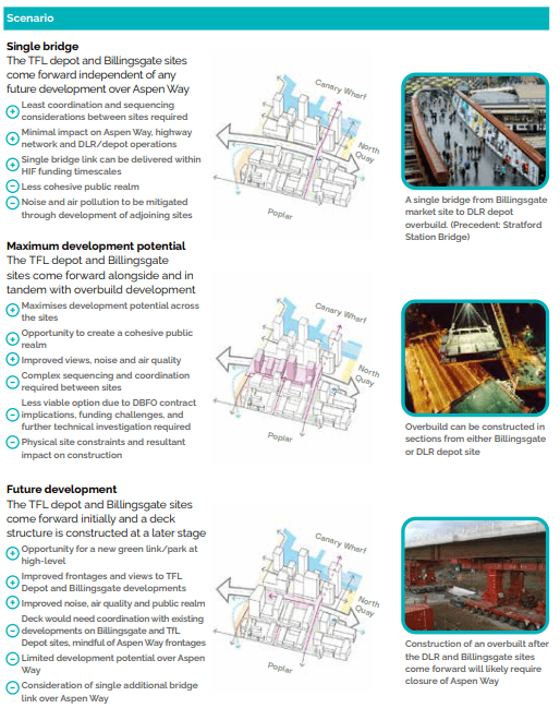
The maximum and future development scenarios, whilst these are much more ambitious in scale and impact would be more expensive to plan and implement.
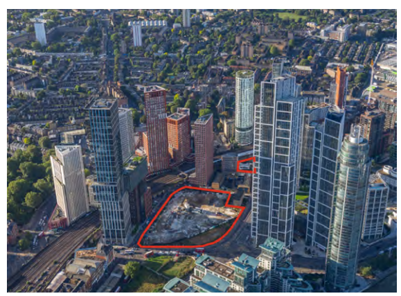
Whilst there is currently no indication of the number of potential new homes and commercial floor space that could be delivered on the 15.11-acre site, it is known that at least 1.8 acres of the site are being set aside for Open Space.
However, the site does include the 3-hectare North Quay which was given outline masterplan consent in 2020 for a 2.5million square foot mixed-use space.
Furthermore, a similarly sized but separately planned scheme being built as Wood Wharf will contain 5 million square feet of space, which will include 2 million sq ft of office space and 3,330 new homes due for completion in 2028.
Whilst an undertaking would be unprecedented for London, similar schemes have been delivered around the world.
Most notably Boston’s Big Dig, in essence, involved the rerouting of Interstate 93 was diverted and rerouted into, purpose-built tunnels which then enabled the demolition of the existing post-war flyovers and secondary improvements in active travel and green public space provision.
In areas of high housing need and the blight inflicted by an effectively 6-lane surface level motorway in inner-city London, the invisible hand is likely to deliver and hybrid of the two.