Croydon Council’s planning committee will sit to determine plans, which propose demolishing a row of semi-detached homes and buildings on top of a car park adjacent to a national rail station in the south London suburb.
The proposals that have been recommended for approval by their planners are subject to approval by the Greater London Authority before the completion of the legal agreement to secure the following planning obligations.
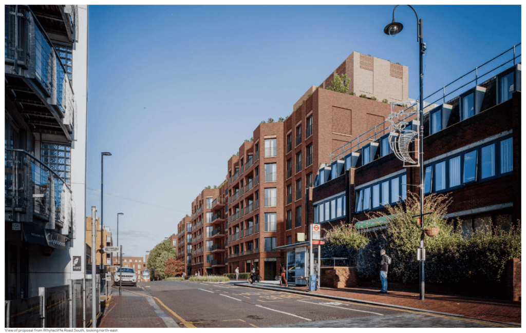
The application submitted by developer RAA Development Group Ltd, Regent Land, and Fund, seeks the demolition of three terraces of houses, redevelopment of these, and the existing surface-level car park.
If approved a series of five buildings ranging from 5 to 9 storeys would provide 238 residential units with a replacement station car park, together with ancillary community indoor space, disabled car parking, communal amenity space, and improvements to the public realm on Whytecliffe Road South.
The proposed development would provide 31.7% affordable housing by habitable room, which amounts to 74 homes, at a 66:44% split between London Affordable Rented (LAR) homes and intermediate shared ownership (SO)
homes. This offer has been independently scrutinised and is the maximum reasonable affordable housing policy-compliant provision.
The proposed development would provide 60 three-bed units, which amounts to a 25% three-bed offer, which is below policy requirements of 40%. However, the planning benefits of the scheme, specifically the affordable housing offer, outweigh this.
However, this represents a reduction in the number of homes from 244 to 238 and alterations to the unit mix including an increase in the number of three-bedroom homes, alongside the reduction in the number of station car parking spaces from 175 to 125.
Due to the site’s proximity to Purley railway station and therefore high PTAL score of 6b, the scheme is expected to be a car-free one except for disabled blue badge spaces and the replacement of the car park associated with the train station.
This would be further supported by a new, network rail cycle parking and repairs hub. Areas have been highlighted as potential areas for public art, to aid wayfinding and add animation to the streetscape.