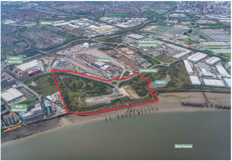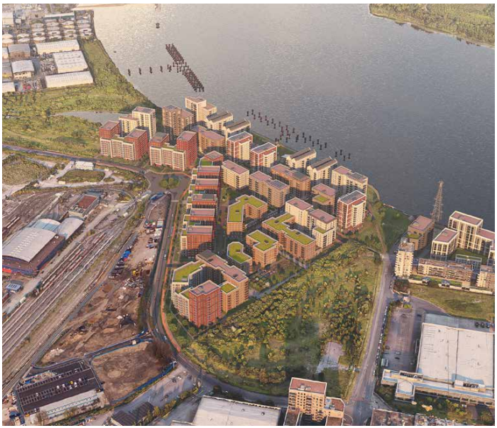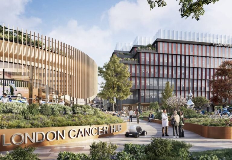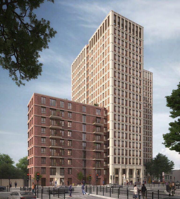
Proposals for the phased redevelopment of a large brownfield site have been validated with the London Borough of Newham, which is seeking planning permission for both outline and detailed / reserved matters. Berkeley St William is the applicant and landowner behind these proposals.
Before the Beckton Gasworks opening the application site was predominantly marshy pastureland. In 1895 the marshland was replaced by the footprint of the Gaslight & Coke Company works which was the largest in Europe until it closed in 1969, playing a significant role in providing gas for the country. The site was not only the largest gasworks in Europe from 1879 to 1970, but it also operated an associated Beckton Product Works from 1879 to 1970 using gas production by-products such as ammonia, sulfur, and coal tar to produce further products which introduced other sources of contaminants, over and above what you would usually expect for gasworks facilities, to the area.
The first phase of the Beckton Riverside developments, sites within one of the largest areas and Opportunity Areas in London, was identified as having the capacity to deliver 36,300 new homes and 55,700 new jobs. This level of growth is intended to be supported
by strategic transport infrastructure improvements through a DLR line extension to Beckton.
Within the southern part of the Site, a 3.5-hectare area of land is currently subject to a safeguarding direction associated with the Thames Gateway Bridge Crossing. The safeguarding direction on the site has been in place since the 1940s with no formal proposals available in the public domain to date. Therefore, it is considered unlikely that the Thames Gateway Bridge Crossing will come forward
and all key stakeholders have confirmed this. The Site adjoins a parcel of land immediately to the south between the site and Atlantis Avenue that the Greater London Authority Land and Property owns.

As a former gasworks site, the redevelopment of this Site is supported by national planning policy, particularly following the Government’s recent consultation on the NPPF which places greater emphasis on the reuse of brownfield land. The Site is identified in the London Plan as a strategic source of housing and is located within the Royal Docks and Beckton Riverside Opportunity Area.
The framework gives substantial weight to the value of using suitable brownfield land for homes and supports appropriate opportunities to remediate despoiled, degraded, derelict, contaminated, and unstable land. Whilst the historic gasworks operation of the Site is now redundant, the site has remained publicly inaccessible for over 150 years. Its economic, social, and environmental contribution to the local community is therefore limited in its current form.
The development is capable of delivering approximately 2,900 new homes including affordable homes and family-sized homes. This represents almost a year’s worth of the borough’s annual housing target (the second highest in London) which is significant when considering the aspirations for growth in this area and the fact that LBN currently only has 2.69 years of housing land supply.
Importantly, the design of the proposed development ensures that it could integrate with any later phases of development at Beckton Riverside. It also proposes a design solution that works for a scenario where an area of safeguarded land for a potential Thames Gateway Road Bridge crossing remains in place and for a scenario where this safeguarding direction has been removed (anticipated to be the likely scenario).

The site sits to the southeast of Beckton DLR depot and lies approximately 0.9 km to the north-east of London City Airport, in an area subject to aerodrome safeguarding, the process by which airspace required for safe and efficient take-off and landing at airports is maintained free of new development. Specific height limits apply at the Site, according to international standards and recommended practices of the International Civil Aviation Organisation (ICAO), as implemented in the UK by the Civil Aviation Authority (CAA) and set out in Civil Aviation Publication (CAP) 168 on aerodrome licensing.
The Public Transport Accessibility Level (PTAL) of the Site is identified as a mixture of PTAL 2 and PTAL 3. The Site is located approximately 320 metres to the east of Gallions Reach DLR station which links to the Elizabeth Line at Custom House and the Jubilee Line at Canning Town. There are several bus stops along Armada Way with two bus routes (262 and 366) providing services every 10 minutes to destinations such as Stratford Bus Station, Gallions Reach, Beckton, and Ilford Station.
It is anticipated that the mixed-use development will be constructed over five main development phases (Phases 1 to 5). The total construction phase of the mixed-use development (comprising both the separate Detailed and Outline Applications) is expected to take approximately 21 years and three months to complete, commencing in Q2 2027 and concluding in Q3 2048.
The construction of the Mixed-Use Development (which is subject to an Outline Planning Application) is anticipated to commence in Q3 2027 and take place over five main phases until Q3 2048, with occupation to occur following the completion of each phase. The first phase is anticipated to be complete and occupied in Q2 2030.

The design code for this application has been produced by JTP Architects and HTA Landscape Architects, for the creation of the almost 2.5 ha of publicly accessible open space.
Cumulatively the Proposed Development will deliver c. 240 FTE construction jobs and once completed between 80 and 270 FTE jobs on-site.
Furthermore, indirect spending arising from new employees and residents will be between £4.1 million per year and £14 million per year and the Proposed Development will also generate substantial CIL and s106 contributions. The precise CIL / S106 liability is yet to be disclosed.
Earlier this year, the same planning authority granted hybrid planning permission for the redevelopment of Bow Gas Works submitted by the same developer. The application site comprises seven disused Grade II listed gasholders, which represents the largest surviving group of Victorian gasholders in the world, and 7 of the 19 listed gasholder remaining in the UK.


