The proposals have been brought forward by Common Projects, on behalf of SGN Mitheridge Ltd a joint venture company that owns the Wandsworth Gas Works and the Calor Gas site, a 1.87-ha in Wandsworth Town, which has been determined by the respective planning authority The London Borough of Wandsworth (the council).
The first engagement with the council in respect to this site was in 2013 engaging in the local plan review process. It was then agreed to release the Hazardous Substances Consent in 2019, to facilitate development sites around the site. It then demolished the gasometer on site in 2020 to facilitate the occupation of recently developed sites around the Site such as the Ram Brewery.
The applicant has commissioned architects Shedkm, Carmody Groarke, Max Architects & BD Landscape, to produce design and access proposals of both the cumulative masterplan as well as the two reserved matters plots for reserved matters seeking consent.
The Site has been underutilised for several years despite it being in the heart of the Wandsworth town urban area. It is located at a key junction between the town centre, the River Wandle, and the River Thames beyond.
Whilst no longer in existence, the gasometer was a fundamental part of the townscape in Wandsworth town for many years, with the earliest photo of the gasometer taken in 1960, and its first appearing on OS maps dated 1958. It comprised c.15 storeys (45m) and would therefore constitute a tall building.

The basement of the currently disused gasometer will be reused as the basement of building B within the masterplan, with an equivalent embodied carbon saving of building the equivalent of 116 newly built homes.
The application is for a hybrid proposal of four blocks and associated public realm, servicing, and landscaping. It will be a phased development comprising the construction of buildings across four development plots to include up to 620 dwellings with affordable housing and up to 4,555 sqm of non-residential floorspace including three spaces within the adjacent railway arches.
Of the 620 new dwellings 182 of those would be for council social rent homes, let to those on Wandsworth’s housing waitlist. Delivered by the means of 66 x 1-bedroom, 79x 2-bedroom, and 37x 3-bedroom.
This would be in addition to 77 London Living rent homes delivered through 19 x 1-bedroom, 55 x 2-bedroom and 3 x 3-bedroom. The applicant confirmed during the committee meeting that three registered providers of affordable housing are interested in acquiring the affordable homes that this development would yield, which would be subject to a future application to be determined by the same committee.
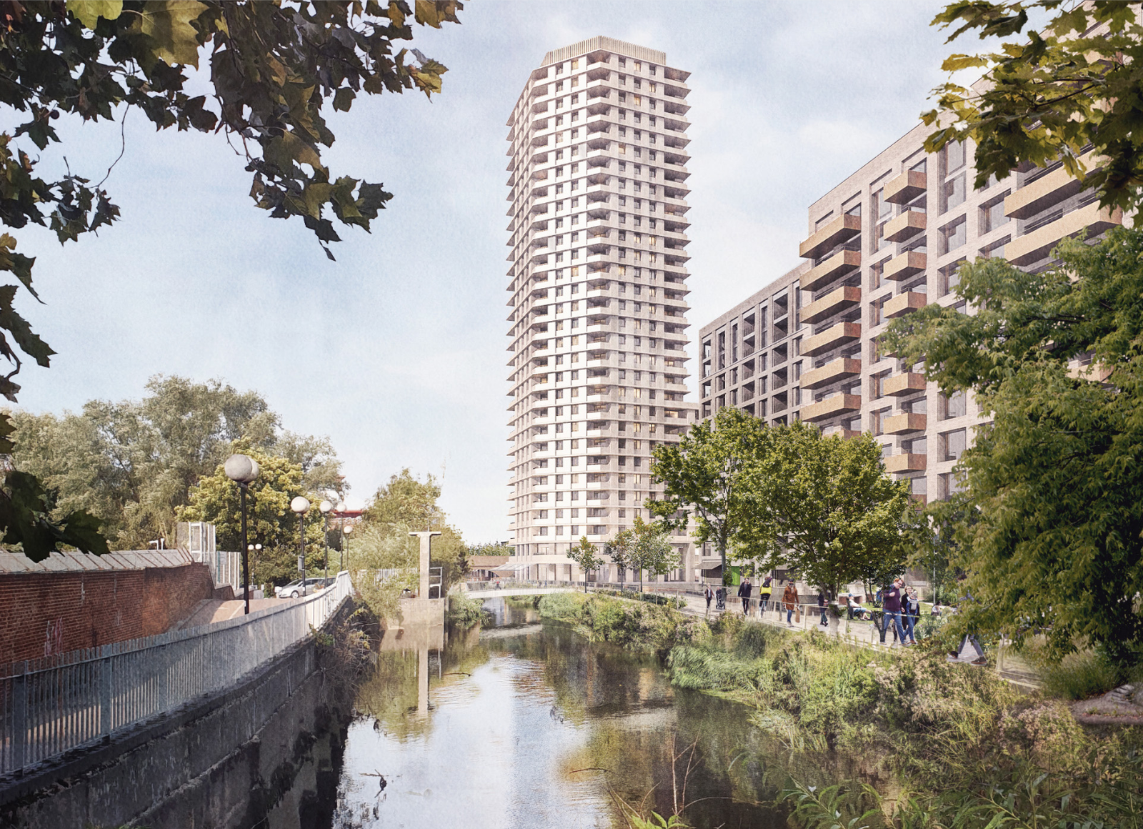
The proposal would have three separate blocks, A1, A2, and A3, along the west side of the site and Block B to the east side of those blocks. It would have a central north-south shared access, an east-west pedestrian route from Swandon Way, through a public space centre of Block B and between A1 & A3, ending at a new park along the Wandle (Wandle Trail).

The park would be the second north-south route with a linear shape between the River Wandle and the A blocks. The north of the park would have a pedestrian/cyclist bridge linking the site with an existing park between the Causeway and the River Wandle. The landscaping and refurbishing of this park, west of River Wandle, forms part of the planning application.
The outline component contains nearly 90% of the affordable homes within the development. The applicant explained that this approach allows any registered provider taking on the project to construct the homes using their preferred and tested models. By not restricting the design of the buildings, the project becomes a more attractive opportunity for registered providers in the market, leading to greater certainty in the delivery of affordable homes.
The site’s Public Transport Access Level (PTAL) ranges from 4 to 5 on a scale from 0 to 6, where 6b indicates the highest level of access to the public transport network. The centre of the site is approximately 400 meters from Wandsworth Town rail station, accessible via Old York Road.
Eleven bus routes are available within a 640-meter walking distance, with stops on Fairfield Street and Ram Street. Armoury Way (A3) and Swandon Way (A217) are part of the Transport for London Road Network (TLRN), for which TfL is the highway authority. Cycle Superhighway 8 runs nearby along Armoury Way and Swandon Way.
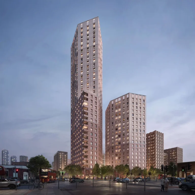
Concerns about the scheme for the most part centered around the height of the 29-floor tower which is referred to on the overarching masterplan as building A, which if built would stand at over times the height as outlined in Wandsworth’s Local Plan and Wandle Delta Supplementary Planning Document (SPD) being double that of those of the buildings along Swandon Way, which lead to the creation of the conservation area at Old York Way.

Officers acknowledge that the area’s character has evolved over the past few years. The emerging context comprises average heights of 7-15 storeys and even a 36- storey tower, as is evident in nearby developments across The Ram, B&Q, and HomeBase sites. If these developments changed the baseline of the average height in the
area, then a tall building height should rise above this baseline
It was also noted there is currently no bus route from Wandsworth Town to the gyratory via Swandon Way and whilst it was a TFL red route, it still has a speed limit of 30 miles per hour all of this despite the increased concentration of residential development alongside the scheme considered by the committee that evening.
The scheme would strengthen the need for more work regarding place-making and improving access to public transport and the possible second entrance to Wandsworth Town railway station which suffers from frequent overcrowding.
The detailed element of the application brings an initial draft Mayoral CIL of £5,028,193.65 and a borough CIL of £21,776,683.63. In addition Mayoral CIL on the outline element of £51,185.45.
The approved scheme following the stage 1 consent by the council, will now be determined by the Greater London Authority (GLA) for stage 2 consent to ensure compliance including but not solely with the London Plan.