The applicant submitted a full application for the redevelopment of One Westmoreland Road in February 2023 (the ‘February 2023 scheme’).
Before submission, the London Borough of Bromley (LBB) engaged in extensive pre-application discussions with the London Borough of Bromley officers and the Greater London Authority (GLA), undertook a Design Review Panel and held a series of public consultation events starting in early 2022.
During pre-application discussions, various design options were presented to officers, with maximum heights ranging between 10 to 22 storeys and varying building depths/footprints.
The scheme was refused in February 2024 with 12 reasons for refusal, relating to matters including flooding, surface water drainage, design, and overdevelopment. Two were overcome reasons 7 and 11 associated with wheelchair-accessible homes and cycle parking.
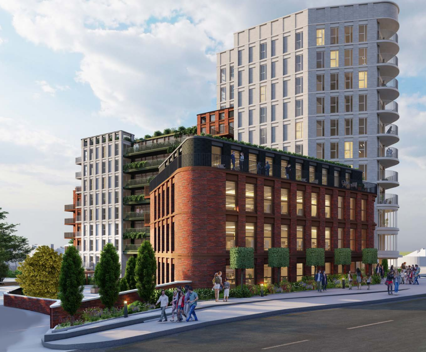
The site comprises a 0.34ha triangular-shaped plot located in Bromley. The Site is bound to the northeast by Masons Hill, to the northwest by Westmoreland Road, to the west by Sanford Road, and to the east by the former St Mark’s School site. High Street Bromley is to
the north of the Site.
The Site is currently occupied by a 3/4 storey former Department of Health and Social Security office building. The Bullers Wood Boys School temporarily occupied part of the Site but vacated it in August 2021. The Site has been vacant since. Before this, the building
was in use as offices. The existing building dates from the 1950s and has a brick and concrete frame and a Z-shaped plan form.
There is a significant change in ground level across the Site, sloping down from Masons Hill to Sandford Road by a full storey in height. A culverted section of the River Ravensbourne runs under the existing building from the west to the east of the Site. The Site lies partly
within Flood Zone 2 with the remainder in Flood Zone 1. There is also a sewer running across the Site.

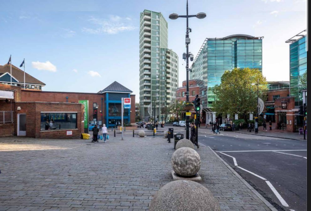
The Site is very well connected as demonstrated by its excellent Public Transport Accessibility Level (PTAL) score of 6a (where 1 is the lowest and 6b is the highest). Bromley South Station is located approximately 110m to the north of the Site and is served by Thameslink and Southeastern trains. There are bus stops served by several bus routes located immediately adjacent to the Site on Westmoreland Road.
The Proposed Development comprises the comprehensive redevelopment of the Site to provide 107 new BtR homes and 31 specialist older person’s housing (hereafter referred to as ‘later living’) apartments and 1,084 sqm GIA of commercial space across three new buildings ranging in height from 3 to 19 storeys, constructed above a new basement.
A variety of new BtR homes will be provided from studios to two-bedroom homes with a mix of 2 bed 3 person and 2 bed 4 person units. Later Living accommodation is provided as one-bedroom units, except one two-bedroom unit.
The development includes 11 units at London Living Rent (LLR) within the BtR building, providing 27 habitable rooms across a mix of 1-bed (6 units) and 2-bed units (5 units). This equates to 10% affordable (LLR) as a proportion of habitable rooms (27 out of 261) in the
BtR building. There is no affordable housing proposed within the later living building. Therefore, the total affordable housing provision (by habitable rooms) equates to 8.33% across the whole scheme.
It is however of note that LBB failed the latest Housing Delivery Test (HDT) in 2023 (58%), and they are currently unable to demonstrate a five-year housing land supply (5YHLS)
Bromley’s Local Plan is itself based on a superseded London Plan target of 641 dwellings per annum (dpa) which is itself out of date. The adopted London Plan (2021) figure of 774 dpa for Bromley is also soon to be superseded by the latest standard method figure for Bromley when the London Plan becomes more than five years old. This figure is 3,001 dpa, this is almost a fourfold increase on the current London Plan target for Bromley.
The immediate area around Bromley South railway station continues to be subject to other public transport-oriented development including St Marks Square which was completed in the late 2010s, this is in addition to consent from the same planning authority in July 2024 for 353 as well as providing a refurbished and extended Waitrose store which we went into further detail here at the point of submission.