An outline planning application (with all matters reserved) except for access for a strategic scale mixed-use development on Grey Belt/PDL land has been submitted to the Royal Borough of Kingston Upon Thames (“RBKT”) & Elmbridge Borough Council (“EBC”). The application has been submitted on behalf of the applicant, Poppymill Limited, and has appointed architects Marreanor Lavington to produce design and access proposals for the site.
RBKT (and EBC) is facing a severe housing crisis: According to 2024 figures from the Office for National Statistics (“ONS”), the median average house price in RBKT is 13.51 times the median average earnings of a full-time employee working in that area, and 16.08 in EBC.
The London Plan requires RBKT to deliver 964 homes per year, whereas it has been achieving around 400 per annum, and in the last year, a record low of 74. RBKT’s housing requirement is likely to go up in the new London Plan.
RBKT’s own evidence shows that its greatest needs are for family homes, and yet the majority of what has been delivered in recent years – and what the Council is continuing to promote through its emerging Local Plan – does not, and will not, meet these needs in full. As confirmed at the appeal in June 2025, RBKT currently has a 1.48-year supply of housing, with EBC’s published position being just 0.9 years (albeit we understand EBC recognises it is currently around 1.8 years).
RBKT has significantly underperformed in delivering affordable housing, achieving only 10% of its cumulative
target since 2011/12, leaving a shortfall of 6,637 homes. Meanwhile, around 2,100 households remain on the waiting list, with average wait times exceeding 3 years for a 1-bedroom and nearly 18 years for a 3-bedroom home. High numbers of households in temporary accommodation contributed to a £5.8 million overspend in 2023/24.
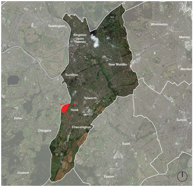
There is a lack of deliverable and viable sites on brownfield land within RBKT’s main centres. To meet its full development needs, development on suitable sites within the Green Belt – including grey belt land – is a necessity.
A Planning Performance Agreement (“PPA”) between the applicant and RBKT was signed in January 2020.
Whilst an initial meeting was held, engagement with the Council has been limited, likely due to more
restrictive Green Belt policy before the introduction of grey belt land, and the Council’s cautious stance
on large-scale development in the south of the borough.
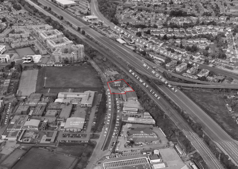
The site comprises a mixture of previously developed land (“PDL”) and inaccessible, despoiled greenfield
land, much of which has been altered by large quantities of licensed/permitted spoil that have been tipped
onto the site in recent years. The PDL comprises a range of large informal and urban fringe land uses, including scrap yards, scaffolding yards, an external storage area and different equestrian uses.
The site is bounded to the north by the Kingston Bypass (A309), to the west by the Esher Bypass (A3), to
the south by Clayton Road, and to the east by recreation grounds associated with the Hook & Southborough Cricket Club, King Edward’s Recreation Ground, and the Hook Leisure Gardens Association (allotments) – much of which is owned by RBKT.
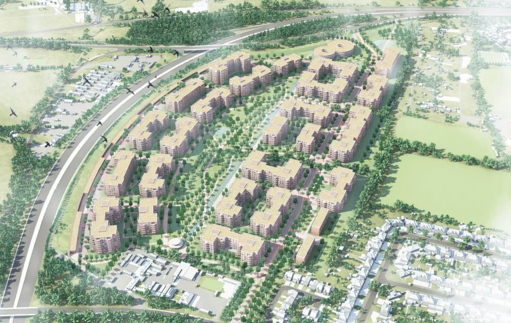
The Illustrative Masterplan presents one potential approach to delivering the quantum of development
defined above as per the vision for the site. The Illustrative master plan is not intended for approval.
Rather, it provides an indication to stakeholders and the community as to how the development could
potentially come forward within the constraints set out by the Parameter Plans and Design Guide. It shows what sort the development consulted for Hook Park could become within the proposed parameters.
An illustrative masterplan has been submitted, which has been used to inform the environmental statement and other supporting application materials.
Within the headline figure of 1,952 new dwellings comprising 601 social/affordable rent homes, 372 intermediate/key worker homes, 979 later living and private sale homes, and 104 care units within a care home. Again, this is only illustrative. For example, whilst provision has been made for 50% affordable housing – with a split of 70% low-cost rent and 30% intermediate housing – the exact types/quanta of affordable housing products will be determined at the detailed design stages, with the applicant seeking funding from the Mayor of London’s affordable housing programme (AHP).
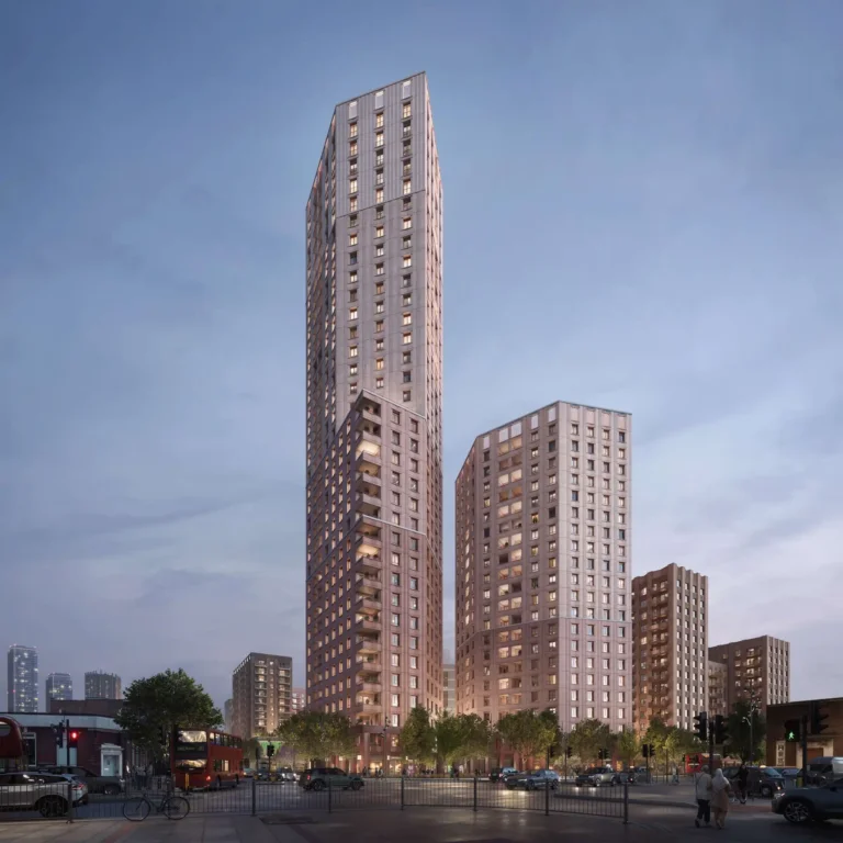
In the Illustrative Scheme, a variety of mansion blocks are proposed to respond to their specific location and
programme. Overall, they follow a similar language and materiality, creating a strong townscape coherence
and a clear neighbourhood feel. The large and medium-sized mansion blocks rely on two double cores with minimised corridor length. The U-shape, with its articulated corners, maximises the percentage of dual and aspect units. Articulation of the massing, typical for mansion blocks, is proposed in the form of built balcony bays. Careful plan design and orientation within the masterplan avoids single aspect, north-facing units.
A Tree Removal and Retention Plan is included in the DAS. This is based on the Tree Survey, and an Arboricultural Impact Assessment has also been submitted. It confirms that there are 121 trees or
groups of trees in and around the site (22 Category A; 32 Category B, 47 Category C, and 20 Category U).
Five trees have been identified as veteran specimens, and there are 35 trees or groups of trees subject to
Tree Preservation Orders (“TPO”).
Whilst detailed layouts are not known at this stage, the Illustrative Masterplan requires the removal of 28
trees, two hedges, and 21 groups of trees, as well as the partial removal of a further five groups and one
hedge. This includes nine trees subject to a TPO, all of which are dead. No Category A trees are proposed
to be removed.
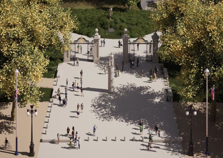
An Open Space Provision Plan based on the Illustrative Masterplan shows a total of 8.9Ha of accessible open space is provided across the site, as well as 2Ha of non-accessible open space.
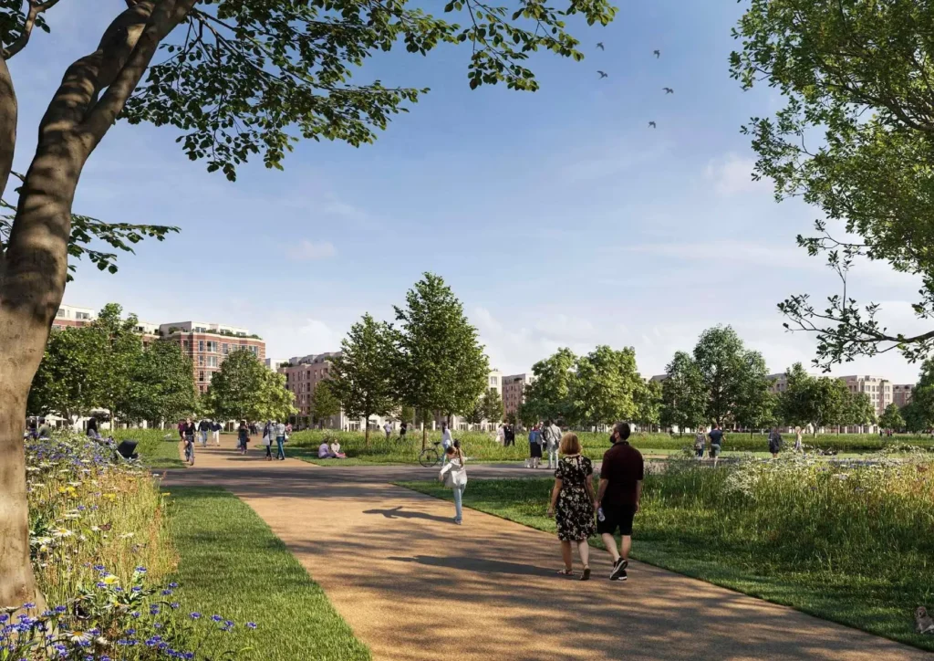
Overall, approximately 50% of the site is proposed as Green Infrastructure, including a new and publicly
accessible local park incorporating play and natural and semi-natural greenspace in the form of a parkland
landscape, gardens and courtyard spaces, a biodiversity corridor, and wetland areas associated with the
existing watercourse and water attenuation areas.
At this early stage, ground floor space has also been earmarked but will be subject to future detailed reserved matters for: gym floorspace, workspace, community centre floorspace, public house floorspace, 1,000 sqm of active travel hub floorspace, and pavilion parking hub floorspace at the very north of the site. This is necessitated by the scheme’s lower Public Transport Accessibility Level (PTAL), with local bus routes tweaked to serve the thousands of residents as well as in with TFL targets on active and public transport usage.
Adjacent to the access point from the Kingston Bypass, a ‘Mobility Pavilion’ is envisaged. The Pavilion not only alleviates the public realm from parking pressure, but it also turns cars into a travel option, like a bus or train:
a ‘parking station’ at a maximum 10-minute walk away. The Pavilion has generous floor-to-floor heights, allowing it in the future to be transformed to programme other than car parking
Given the site’s scale, complexity, and multi-phase nature, it is anticipated that the full buildout and submission of all Reserved Matters applications will extend over a period of at least 10 years. However, early phases – including enabling works and key infrastructure – are expected to come forward promptly following the grant of outline planning consent.
We have previously published an article about a reserved matters, an application for a brownfield site in nearby Tolworth which we published in March of this year which is currently under consideration by Kingston Council.