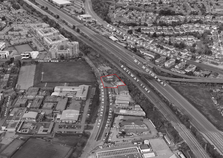
Proposals in support of an application prepared by London Placemaking on behalf of Avion Rise Limited (the applicant) in support of an application for planning permission, submitted to the London Borough of Barnet (‘LBB’), for the redevelopment of Land Adjacent to Grahame Park Way and Avion Crescent.
Permission is sought for the demolition of the existing buildings and redevelopment for the use of residential and replacement community use in new buildings up to ground plus 13 storeys in height, including plant, car and cycle parking, hard and soft landscaping, new access arrangements and all other works associated with the development.
The Site is currently occupied by a single storey, prefabricated concrete building, which is operated by Trinity Church, together with a timber outbuilding and a portacabin, arranged across a predominantly hard surfaced parcel of land. Development on and adjacent to the site comprises light industrial buildings of varied age and quality, reflecting incremental development over time.
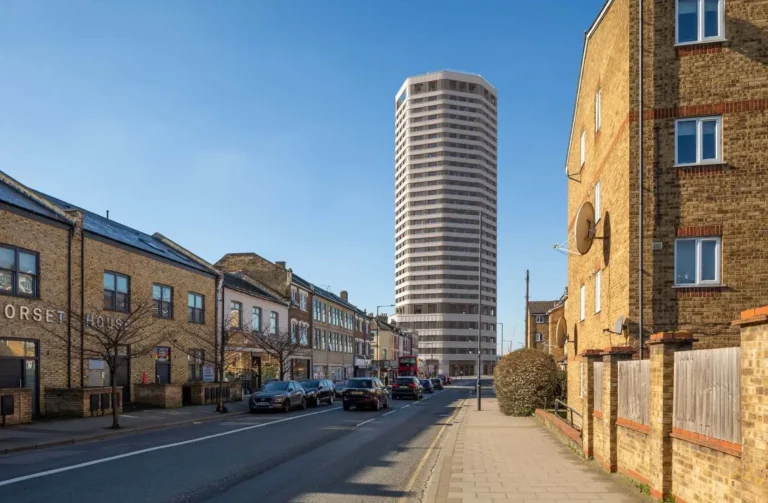
he proposed development has a Public Transport Accessibility Level (PTAL) rating of 1a but is well connected and has access to good public transport links including bus routes, cycle paths, and the tube network, ensuring easy access to essential amenities and sustainable transport options. Bus routes 303 & 642 run adjacent to the site and Colindale underground station, serviced by the Northern Line, is a fifteen-minute walk southwest of the Site.
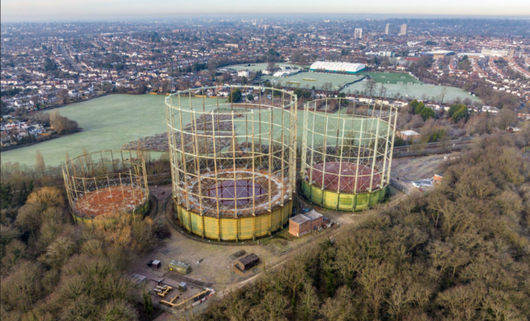
The Site lies within the Colindale and Burnt Oak Opportunity Area, an area that has undergone significant change over the past two decades. Originally designated as an intensification area in the 2004 London Plan and now identified as a Growth Area in the adopted Local Plans of both LB Barnet and LB Brent, Colindale has experienced sustained redevelopment and estate renewal.
he public consultation programme was carried out between January and February 2025 and was designed to ensure that local residents, businesses and community stakeholders were able to engage with the proposals through both in person and digital means, a total of 39 people attended the public events, and 49 feedback responses were received through a combination of in person and online submissions.
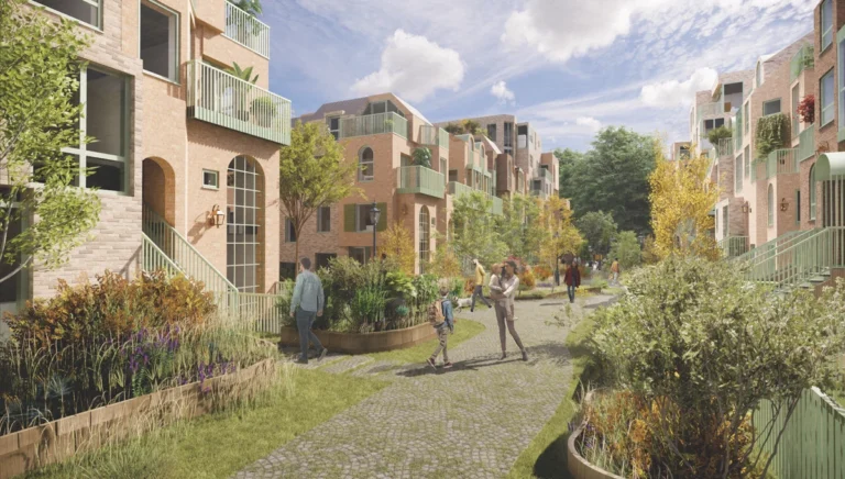
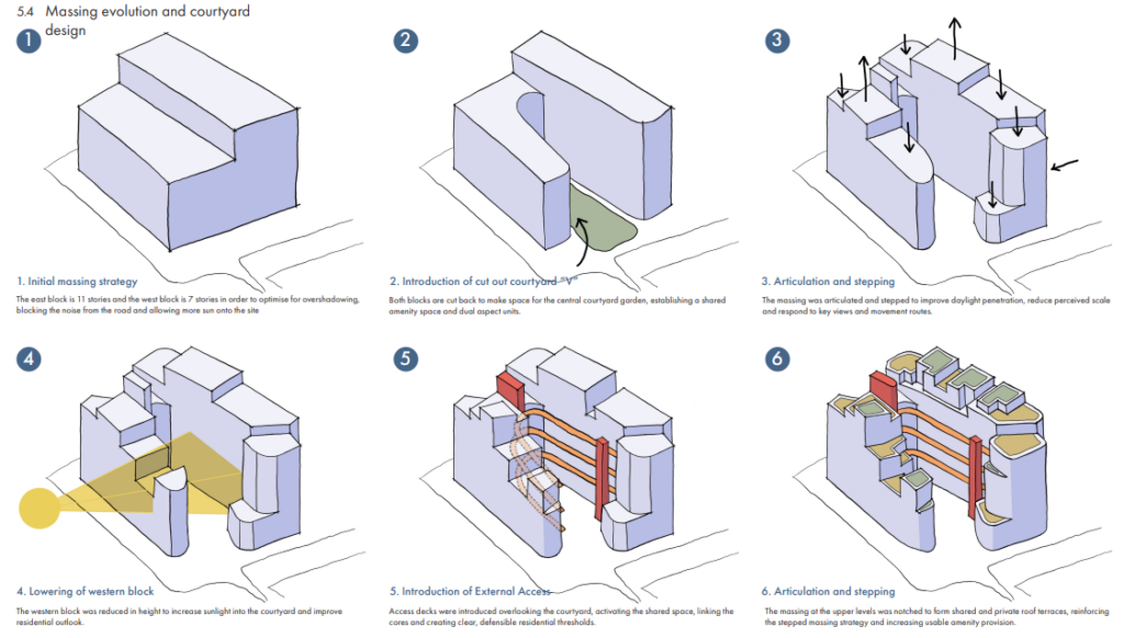
The proposed building is composed as a crescent form that carefully steps and shifts to cradle a central landscaped courtyard. The scheme has been calibrated to respond to its infrastructure context and surrounding urban grain, while establishing a coherent and legible identity.
The western massing defines the primary street frontage to Grahame Park Way, forming an active and articulated urban edge. A central opening within the massing, brought down to first floor level, marks the principal access to the courtyard and establishes a recognisable architectural moment within the elevation.
The development has a stepped height profile. Elements range from two to seven storeys at lower edges, rising to a maximum of fourteen storeys (ground plus thirteen) toward the rear of the site. Height distribution responds to surrounding conditions and avoids a uniform frontage height.
Height is concentrated along the eastern edge adjacent to the railway corridor. The massing of the eastern block rises to fourteen storeys; however, from level 10 upwards the form steps back and is articulated into smaller elements at roof level. Locating the taller element along this infrastructure boundary reinforces the edge condition and assists in buffering noise from the railway and wider transport corridor.
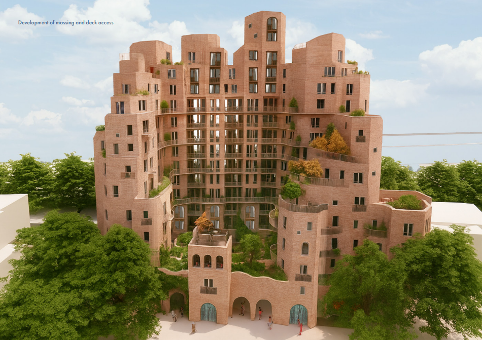
The stepping strategy between the eastern and western elements (two to seven storeys) reduces perceived scale from Grahame Park Way,limits overshadowing of neighbouring plots and safeguards future development potential.
The building is arranged around a large central courtyard, at the heart of the proposal, providing a generous public realm for residents to enjoy. This arrangement allows for the main height of the building along the eastern edge of the site, defined by the main line railway tracks and M1 motorway, so that noise into the centre of the site is blocked out and residents benefit from dual aspect homes.
The north and south wings follow round and step down to a lower building at the front of the site that defines the edge of Grahame Park Way, providing an active street frontage and a clear entrance into the development through a central portico. This building arrangement ensures the homes and amenity space within the development receive excellent levels of daylight and sunlight.
The re-homed church/community facility, in the north-west corner of the site, animates the public realm, both along Grahame Park Way and within the site, creating a focal point for the local community.
The upper floors are served by two cores, located at the northern and southern ends of the building. The east wing is accessed by external decks that connect the two cores, providing these homes with their own external front door and a dual aspect so that their only view out is not of the railway line and motorway. The decks maintain appropriate separation between shared circulation and private domestic space, through the use of voids for daylight and planters in front of windows to ensure the privacy of residents is preserved.
The north and south wings are accessed off an internal corridor where the homes have been organised to ensure they are dual aspect as well, with views of the central courtyard or along Grahame Park Way and Avion Crescent.
The proposed façade design uses subtle variation, natural materials and a stepping form to create a welcoming and picturesque appearance for residents and the wider context. The principal façade material would be a red toned brick with a high level of texture and tonal variation.
Generous windows, balconies and Juliet balconies are arranged in a gently stepped composition to create visual interest and animate the elevations. The fenestration works in combination with the textured brickwork and sculpted form to create a picturesque composition within the streetscape.
The north elevation expresses the stepped building form, breaking down the overall massing. Projecting balconies and recessed core add depth and articulation to the façade. The south elevation incorporates more generous balconies, balanced by an expressed brick lift core. Vertical articulation breaks the façade into a series of elements, reducing the perception of a single continuous block.
The eastern elevation faces across the railway tracks and the M1 which will be experienced at significant speed. The crenelated top and vertical divisions will give this elevation a strong rhythm and provide a gateway moment on the way into London.
the existing building run by Trinity Church currently supports a food bank, community kitchen activities linked to overnight shelters, and will be re-housed in modern and accessible accommodation, that has been design in consultation with the church, to support its ongoing role within the community.
A total of 318 sqm of communal amenity space is proposed within the central courtyard at ground level with private communal amenity space provide via roof terraces on the upper floors. This is in addition to the private amenity space provided to all homes in the form of balconies and terraces.
The central courtyard would incorporate incidental children’s play space to provide safe and stimulating play that would benefit from excellent surveillance from the development. It is anticipated that a financial contribution would be made towards additional play space within a local park or the Applicant would be willing to discuss the provision of a Multi-Use Games Area (MUGA) with the local school which would be for the benefit of the school and local community.
It is proposed to provide four Blue Badge parking spaces on-site (3% of dwellings) accessed off Avion Crescent. In the event that further Blue Badge parking spaces are required in the future, an additional nine spaces (7% of dwellings) can be provided on-street on Avion Crescent.
The Proposed Development would involve the demolition of one single storey, prefabricated concrete building, which is currently operated by the church, which is being re-provided within the new development, together with the demolition of a timber outbuilding and a portacabin. None of the existing buildings within the Site are listed, locally listed, nor located within a Conservation Area. Therefore, there are no heritage-based policy restrictions over their demolition.
LB Barnet’s annualised target for net housing completions is 2,364 homes (applying Table 4.1, London Plan Policy H1). The applicable strategic target for affordable housing is 50%. The most recent figures published are for 2022/23 which state that housing completions in LB Barnet for this period was 2,149, or an average of 2,008 over the preceding 5-year period, thereby falling below the yearly target by approximately 356 homes per year (using the 5-year average). The proposed 145 homes would therefore make a significant contribution to Barnet’s housing delivery.
The Mayor requires the on-site delivery of affordable housing on gross residential development to be a minimum of 50% on public land. In order to qualify for the Fast Track Route, whereby a viability assessment is not required at application stage, proposals must meet or exceed the threshold level of affordable housing on site without public subsidy.